Tasmania's east coast is one of Australia's most rewarding self-drive routes, threading together pink granite boulders, sheltered bays, and quiet fishing villages across roughly 300 kilometres of unhurried road. For couples in their 50s, 60s, and 70s, the pacing suits beautifully — short daily drives, towns with good cafes, and accommodation that ranges from waterfront cottages to well-run motels. This guide covers the full loop from Hobart north to the Bay of Fires, back through Freycinet, and south again via the Tasman Peninsula.
Why this road trip suits over-50 couples so well
The east coast of Tasmania moves at a pace that older travellers tend to appreciate instinctively. There is no single landmark you are racing toward, and no pressure to cover enormous distances in a day. The Tasman Highway runs close to the coast for much of its length, which means you can pull over at a sheltered beach, sit with a thermos, and simply watch the light change on the water. That kind of unhurried travel is genuinely restorative.
For couples where one partner has a lower threshold for walking or standing, the route is forgiving. Many of the best moments — the orange-lichen boulders at the Bay of Fires, the view over Coles Bay, the sea cliffs of the Tasman Peninsula — are reachable without long hikes. Where longer walks exist, there are almost always shorter alternatives, and this guide notes both honestly.
The driving itself is manageable. Most days on this itinerary involve between 90 and 150 kilometres of road, much of it through open farmland and coastal bush with light traffic. Tasmanian roads are generally well-maintained on the main east coast route, though some side roads to beaches are unsealed. A standard two-wheel-drive hire car handles everything described here.
When to go: summer warmth versus autumn quiet
December through February delivers the warmest and longest days on the east coast, with average maximums around 20–23 degrees Celsius in coastal towns. The water is swimmable by Tasmanian standards, the wildflowers have settled into summer grasses, and evening light lasts until well past eight o'clock. These are genuinely pleasant conditions for older travellers who feel the cold. The trade-off is that accommodation books out earlier and costs more, particularly around the Christmas and January school-holiday weeks.
March and April offer a strong alternative. Crowds thin noticeably after Easter, accommodation prices ease, and the deciduous trees in the Midlands and some coastal gardens turn copper and gold. The days are shorter but still comfortable for driving, and you are far more likely to have a beach at the Bay of Fires largely to yourself. Temperatures can be brisk by late April, so packing a warm layer for evenings is sensible regardless.
Winter and early spring — June through August — are genuinely cold on the east coast and some smaller operators close or reduce hours. Unless you specifically enjoy off-season travel and are prepared for closed cafes and changeable weather, the east coast rewards warmer months most reliably.
Day by day: a practical driving framework
A comfortable itinerary runs across seven to ten days depending on how much time you want at each stop. The outline below treats Hobart as both the start and end point, which suits fly-drive packages and allows you to return a hire car at the airport without a one-way fee. Fly into Hobart from Melbourne with Jetstar or Virgin Australia, pick up a car, and plan your first night in the city to give yourselves time to settle in.
Day one and two: Drive north from Hobart on the Midland Highway before cutting east through Campbell Town and down to the coast at Bicheno. The total drive is around 180 kilometres — take it gently, stop for lunch in Campbell Town or Ross, and arrive at Bicheno in the early afternoon. Bicheno is a small fishing town with a sheltered cove, a handful of good accommodation options, and a penguin tour operator that runs guided evening walks along the foreshore. Spend a full day here before continuing north.
Day three and four: From Bicheno, drive north to St Helens (roughly 80 kilometres), which serves as the practical base for the Bay of Fires. St Helens is the largest town on the east coast, with supermarkets, pharmacies, and a reasonable range of accommodation including self-contained units well suited to couples who prefer cooking some of their own meals. Day four is your Bay of Fires day — drive or walk north toward Binalong Bay and the Eddystone Point area, where the orange lichen on granite boulders is at its most vivid. Day five and six: Return south through Bicheno and continue to Coles Bay and the Freycinet Peninsula, around 90 kilometres. Freycinet is where you will want to linger. Day seven and eight: Continue south to the Tasman Peninsula, around 170 kilometres via the Arthur Highway, for Port Arthur and the sea cliffs before returning to Hobart the following day, roughly 100 kilometres.
The Bay of Fires: what to expect on the ground
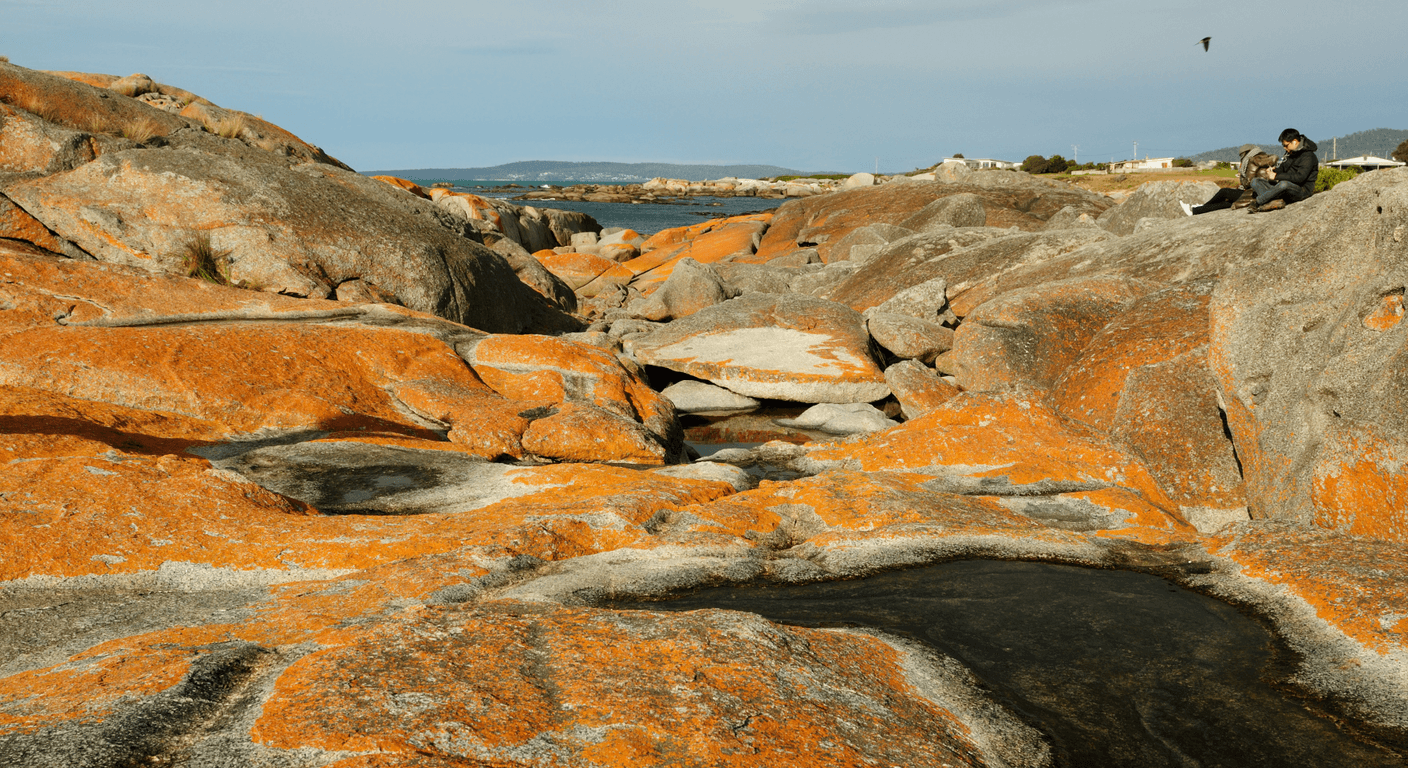
The Bay of Fires is not a single beach but a stretch of coastline running roughly 30 kilometres from Binalong Bay in the south to Eddystone Point in the north. The name refers to the orange and rust-coloured lichen that coats the granite boulders along the shore — a colouring that is most vivid when wet or in low morning light. It is a genuinely distinctive landscape, and photographs rarely do it full justice.
Binalong Bay is the easiest entry point for couples who prefer minimal walking. The township is small but has a well-regarded cafe and a beach that is safe for wading. The road north from Binalong Bay toward The Gardens and Grants Lagoon is partly unsealed but passable in a standard vehicle when dry — check conditions locally before heading out, as the surface can deteriorate after rain. The walk between boulder outcrops along the waterline is uneven in places, so footwear with grip is worthwhile.
For those who want a more immersive experience without the physical demands of independent walking, Pennicott Wilderness Journeys operates a guided multi-day Bay of Fires Lodge walk that includes accommodation in a remote eco-lodge. It is a premium product at a significant price, but it removes all logistical decisions and suits travellers who want the landscape without the navigation. Check current availability and pricing directly with the operator at pennicottjourneys.com.au.
Freycinet and Wineglass Bay: how to experience it at your own pace
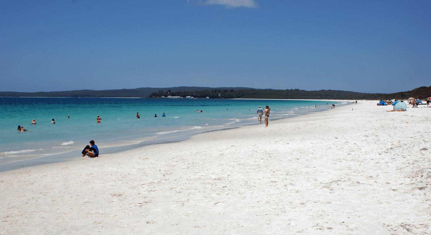
Wineglass Bay is one of those places that appears on every list of Australian natural wonders, which means managing expectations is useful. The bay itself is beautiful — a clean arc of white sand between pink granite headlands — but the classic view from the Wineglass Bay Lookout requires a walk of around 2.6 kilometres return with a significant uphill section of roughly 300 metres elevation gain. For couples who are fit walkers, this is very achievable and takes around 90 minutes at a relaxed pace. For those with knee concerns or low cardiovascular fitness, it is worth being honest with yourselves about the gradient before committing.
There is a genuine alternative. The Freycinet Peninsula Circuit and the beach walk from Hazards Beach are both longer but flatter options for those who want to reach the bay at water level rather than from above. Parks Victoria — or more precisely, Parks and Wildlife Service Tasmania — has trail condition information on its website at parks.tas.gov.au, and the visitor centre at the park entrance is staffed and can advise on current track conditions and accessibility options.
Coles Bay township, just outside the park boundary, has accommodation ranging from a well-regarded resort to small self-contained units. Freycinet Lodge sits within the park itself and offers cabin-style accommodation with good accessibility across much of its range. Book well ahead for summer. Dining options in Coles Bay are limited to a handful of establishments, so if you are particular about food, checking what is open in the current season before you arrive is sensible.
The Tasman Peninsula: Port Arthur and the sea cliffs
The Tasman Peninsula sits at the end of a narrow isthmus south-east of Hobart, and the drive down the Arthur Highway through Sorell and Dunalley is straightforward, around 100 kilometres from Hobart. Most visitors come specifically for the Port Arthur Historic Site, which is one of Australia's most significant convict heritage sites and a genuinely absorbing place to spend a full day. Entry includes a guided walking tour and a harbour cruise, both of which are manageable for most mobility levels. The site is large, so comfortable shoes and a willingness to pace yourself matter.
What many visitors overlook is the coastal scenery of the peninsula itself. The Tasman National Park contains some of the most dramatic sea cliffs in Australia, rising over 300 metres in places, and there are short walks to cliff lookouts that require very little physical effort. The Tasman Coastal Trail is available for more serious walkers, but the lookout at Cape Hauy is a long and moderately demanding return walk — the shorter Cape Pillar circuit alternatives may suit better. Check current track information at parks.tas.gov.au before setting out.
Accommodation on the peninsula is concentrated around Port Arthur township and Taranna. Options are more modest than at Freycinet — motels, self-contained cottages, and a few guesthouses — but the quality has improved steadily. Indicative costs for a comfortable self-contained cottage run around $180–$280 per night depending on season, but confirm current pricing directly with operators. Staying overnight on the peninsula rather than day-tripping from Hobart gives you the option of the Port Arthur Historic Site ghost tour in the evening, which is a well-run experience for those who enjoy that kind of thing.
Practical matters: hire cars, costs, and pacing
A standard automatic hire car is all you need for this itinerary. Hobart Airport has the major hire car companies represented, and booking in advance — particularly for summer travel — gives you better choice and often better pricing. Indicative costs for a week's hire of a small automatic run roughly $600–$900 depending on the company and season, but confirm current rates directly with the hire company. Petrol stations are present in all the main towns described here, though the distances between them in more remote sections of the Bay of Fires area mean keeping the tank reasonably full is sensible.
A Tasmania National Parks Pass is worth purchasing if you plan to enter Freycinet and the Tasman National Park on the same trip. An eight-week vehicle pass costs around $50–$60 at the time of writing — confirm the current price at parks.tas.gov.au before you travel, as fees are reviewed periodically. The pass covers both parks and pays for itself quickly.
For couples where one person tires more easily, building in a rest day — particularly at Freycinet or St Helens — makes the whole trip more enjoyable rather than a series of checkboxes. The east coast rewards slowness. The best cafes tend to be in the smaller towns: the Freycinet Marine Farm near Coles Bay for oysters, Bicheno's small main street for coffee, and the various St Helens options for a longer lunch. None of this requires advance booking, which suits the kind of flexible itinerary that works best for this route.
Key takeaways
- The Tasmania east coast road trip is most comfortable over seven to ten days, keeping daily drives between 80 and 180 kilometres.
- Summer (December–February) offers the warmest conditions; autumn (March–April) delivers quieter roads and lower accommodation prices.
- A Tasmania National Parks Pass covering Freycinet and the Tasman Peninsula is around $50–$60 for eight weeks — confirm current pricing at parks.tas.gov.au.
- The Wineglass Bay Lookout walk involves around 300 metres of elevation gain — a genuine consideration for travellers with knee or cardiovascular concerns.
- St Helens is the most practical base for the Bay of Fires, with the best range of services and accommodation on the north-east coast.
- Port Arthur Historic Site entry includes a guided tour and harbour cruise, making it a full day's activity without needing to plan additional excursions.
Recommended partners and links
Indicative prices only — always confirm with the operator before booking.
Frequently asked questions
Do you need a four-wheel-drive vehicle for the Tasmania east coast road trip?
No. A standard two-wheel-drive automatic hire car is sufficient for all the main roads on this itinerary. Some tracks north of Binalong Bay toward Eddystone Point are unsealed and can be rough after rain, but they are generally passable in a standard vehicle in dry conditions. Check local conditions before heading out on unsealed sections.
How far in advance should you book accommodation on the east coast of Tasmania?
For December and January travel, booking two to three months ahead is advisable, particularly at Freycinet where accommodation is limited. For autumn travel in March and April, four to six weeks ahead is generally sufficient for most towns, though popular properties at Coles Bay can fill quickly on weekends.
Is the Bay of Fires suitable for travellers with limited mobility?
The most accessible entry point is Binalong Bay, where the beach and foreshore are reachable without significant walking. The rocky sections further north involve uneven terrain and are not suitable for anyone with significant mobility limitations. The guided Bay of Fires Lodge walk by Pennicott Wilderness Journeys removes navigation decisions but still involves multi-day walking — discuss fitness requirements with the operator directly before booking.
What is the best way to get to the start of the east coast road trip from Melbourne?
Fly into Hobart Airport from Melbourne — Jetstar and Virgin Australia both operate this route. The drive from Hobart Airport to the east coast via the Tasman Highway takes around two to two-and-a-half hours to Bicheno and three to three-and-a-half hours to St Helens. Hire cars are available at the airport from the major companies.
Can you do the Port Arthur Historic Site without extensive walking?
Yes, to a reasonable degree. The site is large and the ground is uneven in places, but the main precinct is navigable without covering great distances. The included harbour cruise requires boarding a small vessel at the jetty. Wheelchairs and mobility aids can be used in much of the main precinct — contact the Port Arthur Historic Site management directly at portarthur.org.au for current accessibility information.
Got a tip, a price update or a story from this route? The community would love to hear it.
Share your views on our Facebook page— Seniors and Solo Traveller Stories